Everything you need for geospatial APIs
🚀
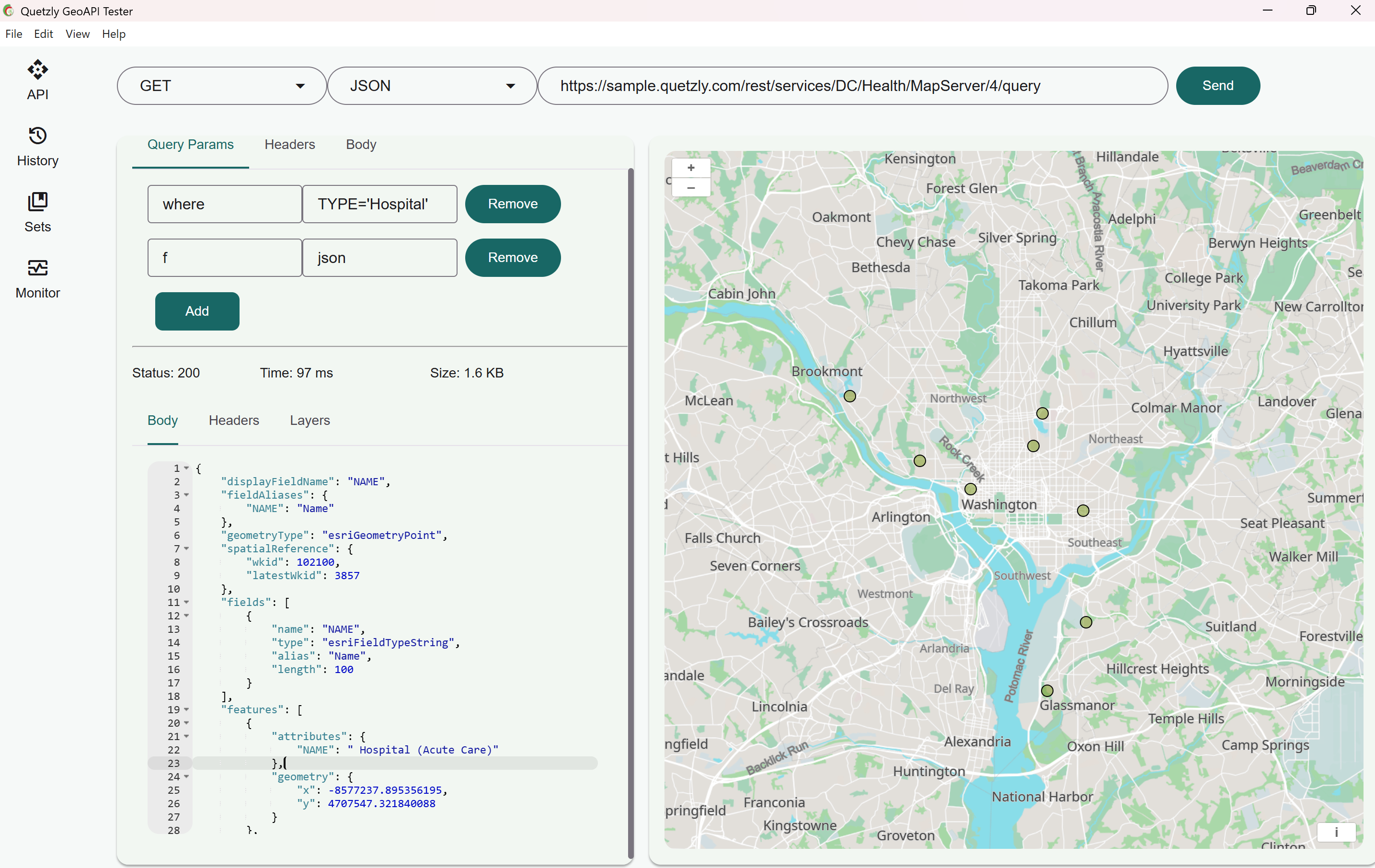
Test APIs Fast
Send requests (GET, POST, PUT, PATCH, DELETE), tweak headers and query params, and inspect JSON responses with an integrated editor.
📊
Monitor Endpoints
Track service health and status over time with configurable intervals and a clear history of checks.
🗺️
Visualize on a Map
Render WMS, WFS, and ArcGIS services, toggle layers, and zoom to extents—then export data as GeoJSON or Shapefile.
Built for Developers & IT Professionals
Quetzly bridges the gap between robust GIS expertise and modern developer workflows. Speed up geospatial development, reduce downtime, and deliver high-quality location services.
Supported Services
WMS
WFS
ArcGIS Map Service
ArcGIS Feature Service
GeoJSON
JSON (Location Data)
From request to live map in seconds
Join our beta program to get early access and help shape the future of GeoAPI testing.
Have questions or feedback? Share your thoughts